Showing posts with label walkability. Show all posts

Sunday, July 7, 2013

Brooklyn nostalgia trip (not for hipsters) -- Part I


Let's take a Brooklyn break.
Brooklyn street box -- Kings Plaza mall
Let's take a break in southeast Brooklyn, where I grew up. A place where hipsters are apparently still few in number. No subway to take you directly to Manhattan; no sidewalk cafes. Some pretty awful, gentry-repellant features -- along with a surprising degree of compact walkability and urban amenity. The image at left might lead you to think the area is a wasteland, but the urbanism is there. The contrasts might possibly make the place more interesting than a Disneyland paradise of narrow streets.

The New York Times has characterized the non-gentrified parts of Brooklyn as either "rough-edged" or anachronistically suburban. Residents of the more  "suburban" areas are portrayed as reveling in an abundance of parking and as preferring "manicured lawns" to "reimagined 19th-century row houses." I'm by no means familiar with every part of Brooklyn -- gentrified or not -- but this suburban characterization of the borough's more outlying areas sounds inaccurate to me.

The neighborhoods that I want to focus on in this and a forthcoming companion post -- Old Mill Basin, Flatlands, Georgetown -- actually exhibit what I think is a rather unique mix of walk appeal and trashy sprawl, with the sprawl elements perhaps protecting the area as a whole from an undesirable socioeconomic "upgrade."

The residential construction in these parts -- dense without being overcrowded, consisting mainly of brick single-family and multifamily rowhouses and small wood frame homes on very modest plots -- could hardly be improved upon, as we'll see below. The commercial areas, by contrast, encompass everything from traditional shopping streets to hideous strip malls, to the windowless hulk of Kings Plaza. But however gargantuan their parking facilities may be, they are still easily accessible by public transit and get plenty of foot traffic from the locals living just across the "stroad."

What I want to convey in these posts are the contrasts and incongruities that make this part of Brooklyn liveable and loveable without being elitist. My "taking a break" idea reflects nostalgic promptings as well as an element of opportunism -- my brother happened to be in the area and took some nice photos, which I couldn't resist using (interspersed with a great many Google street views).  I'm also partly inspired here by the "traditional-city breaks" that form a part of Nathan Lewis' enlightening and entertaining Traditional City/Heroic Materialism archive. Now I know Lewis doesn't care much for Brooklyn, which he dismisses as a collection of 19th-century hypertrophic streets. He's certainly right about the excessive road widths; but my feeling, as someone who grew up in south southern Brooklyn and whose taste for walkable urbanism was formed there, is that you can, somehow, compartmentalize -- look past the hypertrophy and see an excellent housing stock, great connectivity, pleasant street environments, and, on the whole, superior conditions for car-free or car-lite living.

Maybe Kings Plaza and the strip malls lining Ralph Ave. should be filed under the rubric of "good enough urbanism." And maybe their very ugliness plays a role in ensuring that the area retains its heterogeneity!

I'm going to look at the housing styles of southeast Brooklyn in the present post, and (Gd willing) follow up with a discussion of the area's commercial development in a companion post. My idea, again, is that the housing in this part of the world fits the bill for compact-walkable urbanism; the shopping centers are car-oriented and vulgar; and yet the two formats somehow manage to work together.

Housing in Old Mill Basin and Flatlands

Brick rowhouses:

They may not date from the 19th century, they may not be brownstones, but they are rowhouses and they come in a variety of forms -- single-family, two- and three-family; equipped with rear alleys or front-loading garages (which, however, are relatively unobtrusive); presenting all sorts of variations on the front stoop/front porch/front patch of shrubbery theme (yet without over-large set-backs).

I'm going to display a few representative specmens, with comments to follow:


East 58th St. near Ave. J -- three-unit houses with front-loading garages
(Google street view)

 
E. 55th near Ave. O (Google street view)


Ave. T near E. 59th -- (attractive houses, over-wide road)


E. 52 near Ave. J -- rowhouses coexisting with other housing types  (Google street view)


E. 59th between O and T -- single-family rowhouses, no garages, rear alley for parking


E. 55th between J and K  (Google street view)
Avenue J near E. 51 -- The houses look tiny, but include small ground-floor rental units
(Google street view)

Here's what I like about the brick rowhouses:

1) Good enough density: I'm not interested in comparing the density delivered by this housing format with that of some mythical -- or real -- skyscraper city. What's nice about this part of Brooklyn is the implicit understanding, embodied in the built environment, that you have to quit while you're ahead. You have block after block here defined by solid walls of housing, with very little wasted space. You can fit a lot of people into this kind of housing, without making them too uncomfortable.

2) Heterogeneity: The fact that there is a mix of single- and multifamily dwellings means that people of widely-varying economic circumstances, age levels and personal/familial statuses can all live in the same neighborhood, and enjoy the same street environment, as well as the same local services, amenities and shopping facilities. The brick rowhouse is an especially democratic form of housing, in that its multifamily and single-family incarnations don't look too different from each other. Basically, it's all just the same wall of houses, plus or minus a storey, with small stylistic variations. The rowhouse is a great leveler: it blurs socioeconomic distinctions and provides less affluent people with living conditions that are almost identical to those of their better-off neighbors. The owner/landlord of a multifamily rowhouse gets to enjoy a small backyard and the convenience of a garage for his vehicle. The tenant, who might be living just upstairs from the landlord in virtually the same apartment, lacks a backyard and a designated parking spot; but he does get to enjoy residing on the same attractive and people-friendly street, in the same pleasant and safe neighborhood as his landlord, despite his inability to afford a home of his own. He might not need a parking spot because he might not own a car; in any case, he would certainly be able to get by without one in this transit- and shopping-rich area.

I'll illustrate the democratization point further by referring to my own personal experience: while I was growing up, my family (in various configurations) occupied no fewer than 4 of the houses pictured above. We owned a single-family rowhouse while my parents were married, then rented a series of apartments in multi-family rowhouses after they divorced -- first a small ground-level apartment (with entrance next to the garage) during the financially tight immediate post-divorce period, then a larger, upstairs apartment when things had stabilized. While all these upheavals were going on, I was able to attend the same school, keep all my friends, and still feel part of the same general neighborhood. That was a great advantage. Later on, as a young man in his twenties, working full-time and going to college part-time, my brother actually returned to this area and rented one of the small ground-floor apartments on his own. He just liked the neighborhood so much that it seemed natural to to him to return to it, even after the rest of the family had moved away.

2) No snouthouses! Note that many of these brick rowhouses come equipped with 1-car front-loading garages (as well as driveways that effectively provide additional private parking spaces). Note as well that these garages manage not to detract from the pleasantness of the building facades or kill the street atmosphere. The Old Urbanist blog has explored the question of whether townhouses and front-loading garages can work together -- here and here. I think these specimens hold their own alongside those featured in the Old Urbanist posts.


 Small single-family wooden frame houses:

These come  as fully detached houses or as semi-detached pairs, with small front yards, small back yards, and narrow paths (often used as driveways) between them. They are older than the brick rowhouses and, while I was growing up, were thought to be an inferior, less prestigious form of housing. Archie Bunker's house (in Queens) is of this type, reinforcing the blue-collar image. Not having spent much time in the area since the early 1990s, I'm not sure this class distinction still exists -- though the Google street views do show quite a few American flags (perhaps denoting military service or political affiliation?) on the porches of these houses, a sight that is uncommon on the brick rowhouse streets. 

I always had a regard for these dwellings and enjoyed walking along the streets lined with them, even when they were thought (by some) to be disreputable. They vary the scene by breaking up the blocks of brick rowhouses, and by displaying a certain diversity of color, facade, etc. I don't think this is the phony kind of diversity that you have in suburban tract housing. The idea is that the houses all work together to form a complete street environment (just as the brick rowhouses do). They are modest in size, the spaces between them are small, and they create the desired "outdoor room" or enclosure effect that is thought to be essential to the pedestrian experience.

Representative samples:


East 53rd near Ave. O (Google street view)
E. 57th near Ave. O -- jazzing things up with partial brick veneer ( Google street view)


E. 53rd near Ave. S -- co-existing with brick rowhouses ( Google street view)
E. 61st near Ave. T -- small stylistic variations (Google street view)


Mill Ave. and Ralph -- American flags

It's interesting to compare the street environment yielded by these single-family wooden frame houses of Old Mill Basin with the single-family homes that line the streets of "new" Mill Basin -- an enclave that, unlike Old Mill Basin, does fit the New York Times label of "suburbia:" 


E. 64th St. near Mayfair Drive South, suburban Mill Basin
(Google street view)


E. 66th St., suburban Mill Basin (Google street view)
The NYT article linked to above doesn't distinguish between Old and "new" Mill Basin, but when it talks about a "zone of lawn mowers" and a "country club’s worth of swimming pools," it's referring to the newer area that juts into Jamaica Bay and was "whipped up from scratch" by engineers -- not to nearby Old Mill Basin with its more traditional street grid and architectural style.

Why do these two latter photos from "new" Mill Basin scream Suburbia, while the preceding ones from Old Mill Basin don't (and I've deliberately steered clear of the McMansions that have recently replaced many of the original "new" Mill Basin houses)? These aren't huge houses, and the garages don't protrude for a snouthouse effect. The setbacks of the "new" Mill Basin houses aren't any larger than those of the classic Old Mill Basin houses, the spaces between them aren't much larger, and they display similar slight variations of color, window and porch style, etc. Why do these suburban-Mill Basin homes have such a solitary, every-man-for-himself feel? Why, taken together, do they produce monotony rather than harmony? Even as a teenager, visiting friends in "new" Mill Basin, I could tell the difference between this much more expensive/upscale area and the area where I lived, and preferred my own area.

Old Mill Basin/Flatlands housing styles -- subjective/emotional response:

Why do the unglamorous street scenes of Old Mill Basin and Flatlands tug at the heart? (And I believe they could tug at anyone's heart, not just the heart of someone who grew up there.)

Modesty. Simplicity. Staying within bounds. Small parts making up a whole that is greater than the sum. Being separate -- together. Everybody having their own bit of privacy and comfort, that do not come at anybody else's expense. 

These, in my subjective estimation, are the values embodied in the housing styles of Old Mill Basin and Flatlands, and are what give these neighborhoods their peculiar charm. Living within limits, when translated into architecture, apparently has aesthetic merit. Making the most of available space, "a place for everything, and everything in its place." 

Walking these streets -- or even looking at them via Google street view -- is at once restful and stimulating. Simplicity is pretty, and fun.

Charles Siegel's Politics of Simple Living connects traditional neighborhood design with precisely these values of simple living. 


***********************************************************
I'll leave the reader with just one more Google street view that shows how these tranquil, walkable streets coexist with elements of autocentrism and sprawl, in anticipation of Brooklyn nostalgia trip -- Part II:


View of Kings Plaza Lowe's shopping mall, E. 55th St. intersection
(Google street view)


Friday, May 17, 2013

Jerusalem’s Newest Tourist Attraction: Open-Air Escalators in Har Homa


For several years now, Jerusalem’s Har Homa neighborhood has been the test site for an innovative form of underground garbage dumpster. Recently, however, the Municipality announced that Har Homa will be the venue for a somewhat more glamorous initiative: a system of open-air escalators. If all goes according to plan, the escalators will function as a public transportation mode, help residents cope with the neighborhood’s difficult topography, and attract tourists.

Har Homa’s residents – like those of other hilly Jerusalem neighborhoods – are all too aware of the mobility problems occasioned by steep inclines. Although a healthy adult with time to spare might, with only a little huffing and puffing, be able to climb the hundreds of outdoor stairs by which streets are typically connected in these neighborhoods, such is not the case for senior citizens, people with disabilities, mothers with young children in tow, and those faced with time constraints (such as parents who need to get their children to school or kindergarten before proceeding to their workplaces).

One of Har Homa's many "extreme" staircases
Up to now, Har Homa residents have dealt with this problem by using their private cars to get to and from most, or all, local destinations. In accordance with current planning rules, all neighborhood buildings were designed with hefty amounts of off-street parking. As a result, local households have found it convenient to own two cars, and sometimes more. The availability of these vehicles has made it possible for Har Homa residents to get to neighborhood supermarkets, groceries, health clinics, kindergartens, schools, synagogues, beauty parlors, pizza parlors, candy stores, the community center, and all other local destinations without having to climb endless stairs, or take heartbreakingly circuitous detours on foot in order to avoid the stairs.

Unfortunately, the minimum parking requirements, while ostensibly solving problems of local mobility and access, have created their own issues: horrendous traffic in the areas surrounding the neighborhood’s educational institutions and shopping centers, a Wild-West attitude toward parking, air pollution, excessively wide roads, unsafe and unpleasant conditions for pedestrians, and exceptionally unattractive architecture due to the need to house vast numbers of automobiles. All of things are inconsistent with current municipal policy, which seeks to promote walkability and public transit use, and to reduce car dependency to the extent possible.

Enter the Municipality's newest initiative, to be implemented in the coming months: the installation of a state-of-the-art open-air escalator system to supplement Har Homa’s network of outdoor staircases – and, in some instances, to replace those staircases.


Medellin escalator, courtesy of DaniBlanchette, Flickr
Outdoor escalators are operated in quite a few cities around the world, Barcelona and Hong Kong among them. Over the past few years, particular interest has been generated by the impressive system installed in Comuna 13, one of Medellín, Colombia's poorest neighborhoods, whose topography greatly resembles that of Jerusalem’s Har Homa. Unlike Har Homa residents, however, the denizens of Medellín’s most notorious slum have no private cars available to them, and until recently were forced to use stairs equal in number to those of a 28-story building in order to reach the city’s employment and commercial centers. The escalator system, like the cable car system that also serves as a mode of public transit in Medellín, is a social-justice project aimed at improving local residents’ living conditions, connecting them to the city and to jobs, and setting real social change in motion. The success of these initiatives earned Medellín the title of Innovative City of the Year for 2013 (beating out Tel Aviv, which placed second).

One may ask: why is the status of a third-world city such as Medellín relevant to our discussion of a Jerusalem neighborhood, most of whose residents fall somewhere along the middle-class spectrum and own private automobiles that give them mobility both within the neighborhood and outside it?

We posed this question to Deputy Mayor Ruth Sela, holder of the Jerusalem Municipality’s planning and environment portfolios, during a joint interview with her fellow deputy mayor, Gabi Ganon.

Sela: “We need to stop viewing the private car as the default solution to every transport situation, and as a symbol of status and luxury. The private car is simply destroying our built environment, and our health along with it. The present municipal leadership is an enlightened one that wants to advance sustainability and promote public health, and the car dependency that currently prevails in Jerusalem’s peripheral neighborhoods is inconsistent with that approach.

“After all, we’ve turned Jaffa Road into the country’s longest and most attractive pedestrian mall. You can’t go anywhere near the center of town nowadays with a private car, and over the coming years this trend will only intensify. Pretty soon there will be almost nowhere in Jerusalem to take a car to, or park one in – except the peripheral ‘residential’ neighborhoods! So it makes sense to implement our policy in these neighborhoods as well. Rather than each family owning multiple vehicles just so they can get to destinations within the neighborhood, we’re going to enable them to get to those destinations on foot, and to give up at least one family car.”

But, despite what you’ve said about Jerusalem’s core areas becoming increasingly car-hostile, the residents of Har Homa still need to use their cars to get to jobs and shopping centers outside the neighborhood, in the absence of any viable alternative.

Sela: “Of course we can’t hope to advance the escalator project and promote ‘car divestment’ without drastically improving public transit service to the neighborhood. The frequency of the bus lines that serve Har Homa will be increased to every 10 minutes rather than every 20 (or more) – constituting true ‘rapid bus service.’ We’ll also be annulling the parking minimums for residential construction, so it will be a lot harder to own more than one family car.”

Cancelling the parking minimums will surely be an unpopular move. People might start asking whether the Municipality isn’t intervening inappropriately in residents’ lives. If Jerusalemites have grown accustomed to using their cars for every out-of-home excursion, and if they enjoy the feeling of status and power that it gives them, why ruin it for them?

Sela: “Look, as a public official I have to think, and also act, with my constituents’ long-term interests in view – even if that entails decisions that are unpopular in the short run. The prevailing lifestyle in Har Homa and in Jerusalem’s other peripheral neighborhoods is simply unsustainable and unhealthy. The impoverished residents of Medellín’s worst slum are now benefiting from a neighborhood infrastructure that facilitates walking; they will neither want nor need private cars even once their economic status improves. They’re going to stay trim and fit, while the relatively affluent residents of Har Homa will be quivering gelatinous masses. You know, rumors have got round to us in the Municipality that Har Homa residents like to tie their garbage bags to their car antennas and drive with them to the garbage dumpsters located just a few meters from each building. It’s this kind of behavior that I, as a public official, feel obligated to address.”

That does still have overtones of ‘Big Brother’.

Sela: Hey, Mayor Bloomberg of New York City looks out for his public in just the same way – he takes things even farther. Go into a New York restaurant and open the menu – you’ll find that every item has a calorie estimate next to it. Bloomberg’s even trying to prohibit the sale of sweetened beverages in the city, as a public health measure.”

That particular effort hasn't succeeded. It was thought to be too intrusive – and that’s just what people are liable to think about your attempt to separate Jerusalemites from their cars.

Sela: “The escalator project – and the sustainability considerations that lie behind it – are issues of urban and transport planning that fall within the purview of a municipal authority. Not only that, but the question of the automobile’s place in the urban environment is absolutely one that municipalities should be facing up to and answering.”

At this point in the interview signs of impatience could be discerned in the facial expressions and body language of Deputy Mayor Gabi Ganon, who up to now had maintained a polite silence.

Ganon: “With all due respect to my colleague and to her concern for sustainability and public health, I have to take issue with the idea that environmental and health concerns are what ultimately set the escalator project in motion.

“The current municipal leadership is a proudly capitalist one, and it’s not reasonable for the Municipality to undertake projects of this magnitude just to make residents happy and ensure their physical fitness. We’re not a welfare state anymore.

“An initiative has to be potentially profitable – otherwise, how can we fund it? How would we raise the funds for an infrastructural project as complex as the Har Homa escalators?”

Indeed, we were planning to ask just that question. How will the Municipality be paying for the construction and operation of the escalators?

Ganon: “This is the good part. The Municipality won’t be spending a penny of its own money. And it won’t have to go schnorring, either. Two worthy and committed Jews, one Israeli and one from the Diaspora – with the means and the desire to benefit both the city and themselves – will be investing in the project and, in time, will receive an impressive return on their investment.”

How will they get a ‘return’ on a project whose main purpose is to advance the public good, not to generate income? Will users have to pay a toll?

Ganon [chuckling]: “No, no, no toll. It’s an interesting idea, but probably not practicable. No, there are other ways to make money off a project.

“Look, the concept of ‘the public good’ has passed its expiration date – it belongs to the socialist era. Today’s philanthropists have learned this very well. They’ve reached the conclusion – and this is very consistent with Jewish tradition, by the way – that the highest form of charity is enabling others to earn a living, not just to throw money at them. And this is where the escalators fit in. The environmental and health benefits will essentially be by-products. The escalators’ real function is to be a tourist attraction, like the ones in Hong Kong, which upgraded a topographically problematic area and turned it into a vibrant, sought-after commercial quarter! The same thing will happen in Har Homa. You’ve got wonderful views of Bethlehem there – Christian tourists will come in droves, once the proper investment has been made. We might even put in a cable car system to run between Har Homa and Bethlehem, like the one we’re planning to operate between the Old City and the Khan Theater. Kevin Bermeister, the escalator’s main financer (along with Erel Margalit), will buy one of the neighborhood’s residential towers and turn it into a swanky hotel, Erel will open a few non-kosher restaurants, and everybody will profit. It’s a slam dunk!”

What -- drab, monotonous Har Homa, with its endless vistas of ground-level garages, is going to become a tourist destination?


Hong Kong (covered) escalators --
 courtesy of Maucaine via Wikipedia
Ganon: “Why not? They predicted at first that the Hong Kong escalators would be a total failure, but the novelty attracted people and led to the opening of innumerable businesses, shops and restaurants, situated mainly at the escalator system’s entry and exit points. A form of ‘transit-oriented development,’ if you will. Regarding Har Homa, we’ll soften the regulations so that the garages of the residential buildings can be converted into commercial spaces. There’ll be boutiques, cafés and pubs at the ground level of the buildings.”

Sounds like science fiction. But to what degree is this really agreeable to the residents themselves? Maybe they don’t want a pub at the ground level of every building? After all, it’s a neighborhood consisting mainly of young families, most of them religiously observant to some degree or other.

Ganon: “Look, a pub on the ground floor is a negligible price to pay compared with all the money that’s going to be flowing into the neighborhood -- money that will make it possible to provide Har Homa with all of the municipal services that are currently lacking there – a library, a well-baby clinic equal to the patient load, shade structures in the playgrounds, kindergarten buildings and synagogues in accordance with demand, development and maintenance of green spaces. The Municipality will finally agree to take responsibility for all those areas that have been left in Construction Ministry limbo. All the problems that the folks in Har Homa are constantly whining about will finally be resolved!”

Wait a minute – shouldn’t the neighborhood be getting all these services anyway, in return for the arnona [municipal property tax] that the residents pay?

Ganon: Don’t make me laugh. Did you really think residents are entitled to something in return for their arnona? Arnona barely covers garbage pick-up, after you take into account all the other really important things the Municipality has to finance with its limited resources. New sports and entertainment arenas that overrun their original budgets by a hundred million shekels, for instance. And let's not forget cool events like the Formula 1 road show planned for next month. With stuff like that going on, is it any wonder there's no money left for neighborhood libraries? The peripheral neighborhoods need to stop asking what the city can do for them, and start asking what they can do for the city -- then maybe they'll get somewhere."

But does Jerusalem really need yet another tourist destination? Aren’t the Old City and the revitalized downtown enough?

Ganon: “Decentralization and breaking up monopolies -- that's the name of the game. Why shouldn’t other neighborhoods enter the tourism market? Healthy competition between neighborhoods will ensure optimal delivery of tourism experiences to all those who visit the city – that is, to all customers purchasing the Jerusalem ‘product.’ Basically, I want to do in the urban arena what my brother did in the cellular one – open things up to competition. Besides, we’ve come to realize that the Old City and downtown Jerusalem simply won’t be able to handle the load once we reach ten million and more tourists per year. These areas have no carrying capacity. You throw two falafel wrappers on the ground and the city’s filthy.

“We need neighborhoods like Har Homa to take up the slack.”

********
*Note: The above is, of course, a satirical piece; the author hopes that no one will attribute the "interview" statements to any actual Jerusalem deputy mayors, past or present. The "interview" merely aims to take to their logical conclusion certain ideas that have gained currency in recent years, and to provoke thought.

Tuesday, January 17, 2012

Density without walkability in Jerusalem -- a problem of the past, or an ongoing one?


 Unholyland, via Wikipedia (Adiel Lo)
 Michael Lewyn, an American law professor who writes extensively about urban issues, blogged recently at Planetizen about -- of all places -- the scandalous Holyland project, where he happened to stay during a vacation week in Jerusalem.

Refreshingly, Lewyn bypasses the issue of how those giant-towers-perched-on-a-cliff look to the rest of the city -- the visual affront that most Jerusalemites are all too aware of. Instead, he directly addresses a more pervasive and insidious issue, one that is not on most local residents' radar screen: the striking lack of walkability in newer Jerusalem neighborhoods planned for maximum density.

Lewyn is clearly surprised to find that a "pretty dense neighborhood in a pretty dense city [...] may be more confusing to navigate, and separate uses more aggressively, than some sprawling suburbs." He notes the Holyland area's problematic topography, which would have made a grid layout hard to implement; but he also points out that San Francisco, among other places, manages to be walkable despite its hills.

It is bracing to see a visitor to the city hone in on so glaring a problem, precisely in a part of town that most Jerusalemites think of as exclusive. Although a failure to address topography or to strive for walkability has always been pretty much par for the course in the city's more middle-class "ring" neighborhoods, it's sad to be reminded that the elite Holyland project -- a neighborhood that, while not exactly in the city center, hardly qualifies as "peripheral" by Jerusalem standards -- did not elicit a higher degree of planning competence.

It's tempting to regard Holyland as a dinosaur, the last relic of an era when Jerusalem's planning cadre could conceive of no greater neighborhood amenity than a quasi-private exit ramp directly onto the Menachem Begin Boulevard (highway) that connects north and south Jerusalem. It's also tempting to regard Holyland as merely the product of a corrupt political system. It's tempting, but one should resist the temptation and recognize that such a project could never have been erected had there been anything like a local public norm for either aesthetics or walkability. There were no such norms during the 1990s, when Holyland was planned, and I submit that even today, with a more "enlightened" and "transparent" municipal administration in place, there is no level of urbanist awareness that would ensure the walkability of new developments in Jerusalem -- except, perhaps, in certain choice areas.

"Density" has become a big catchword in Israel, and "high-rise construction" is being touted as the way to achieve it. Just last week a major Israeli newspaper's finance supplement devoted a lengthy article to the issue of high-rise construction ("פחד גבהים", "Fear of Heights," Makor Rishon -- Kalkala, issue 753, 13 January 2012 -- apparently unavailable online). Though pointing out that high-rise residential construction has yet to become popular in Israel, the author, Gavriel Wolfson, presents it as unequivocably desirable. One "expert" whom he quotes, Dr. Rina Degani, asserts that if it were up to her, she would "cease issuing authorizations for low-rise construction;" another "expert," Yisrael David (Israel's representative to the Council on Tall Buildings and Urban Habitat) dishes up the quasi-green argument that "there is more room around tall buildings for public spaces such as gardens, parks and children's playgrounds." Both of these statements reflect a discouraging lack of sophistication in the embrace of urbanist concepts.

The idea that residential towers are the sole key to efficient land use in land-poor Israel has been challenged from multiple angles by Ami Ran in an article in Architecture of Israel Quarterly (click here for a rather primitive English translation; the original Hebrew is here). Ran points out, among other things, that the old low-rise Kerem HaTeimanim neighborhood is three times denser than Tel Aviv's "modernist White City" area, and that Tel Aviv's overall density (7000 per square km) is less than half that of "satellite towns" Bat Yam and Givatayim. While he feels that high-rise is the right way to go for commercial uses, he is skeptical about residential towers: "Although it is numerically possible to place a greater amount of residential units on a certain plot, it will ultimately be at the expense of the environment. The larger spaces needed between the high buildings break up the continuum of the city with its variety of urban activities." This latter point essentially refutes Yisrael David's specious "tower in the park" argument in the Makor Rishon article. "More room around tall buildings for public spaces" -- many would counter that this translates into isolated towers that do not integrate into any viable urban fabric, and that the "public spaces" surrounding them tend to be sterile and/or not family-friendly (you can't very well keep an eye on your kids from the 27th floor).

The election, in 2008, of a young and dynamic Nir Barkat as Jerusalem's mayor is generally though to have heralded a new era in local urbanism. Sustainability activist Naomi Tsur, an outspoken critic of Israeli suburban sprawl, holds the municipal planning and environment portfolios and serves as deputy mayor. There is much talk about densifying the city, but any actual concern for walkability seems to begin and end with the transformation of downtown Jerusalem into a large, rather sanitized and elitist, pedestrian mall. The existing mainly-residential neighborhoods are slated for "densification," but little attention is being paid (again, excepting a few select neighborhoods) to what the new projects expected to produce this densification actually look like and how they will be contributing to the urban fabric.

The tower-in-the-park idea doesn't seem to be as popular around here as that of the quasi-gated community. I say quasi-gated because the projects to which I'm referring are not actually gated, but they turn their backs to the street and detach themselves from their host neighborhoods in a manner reminiscent of gated communities.

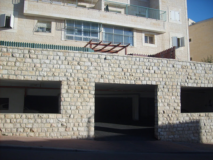
An early example of the quasi-gated community in Jerusalem is the Ganei Katamon project from the early-mid 1990s, in which a cluster of 4-storey apartment buildings surrounds a large inner courtyard. The courtyard is really open to anyone -- there is no "security" to keep people out -- and could thus arguably be considered a neighborhood asset; but most passersby, intimidated by the project's surrounding walls, would probably never think to enter it. From outside the project, greenery spilling over the formidable stone walls softens the visual impact, but doesn't counteract an overall effect of removing human life and vitality from the street. Note the cavernous garage entrance:


A more recent project, one still partly under construction, is Ganei Zion in the gentrifying Katamonim neighborhood (bordering the more upscale San Simon area). This project consists of four 6-8 storey buildings and a residential tower surrounding a "private park." The outside of the project presents a fortress-like view to the surrounding neighborhood of modest low-rise buildings:


It's possible that a project this unattractive at street-level could no longer fly in the Katamonim, due to opposition by vocal residents and to the existence of a master plan for the neighborhood that, while indeed recommending densification (primarily by adding floors to existing buildings), also stipulates certain design features relating to building facades and wall heights, apparently aimed at preventing any more Ganei Zions. Whether this master plan is actually being implemented, and street-hostile projects thereby prevented, I couldn't say. It's worth noting, though, that the local activism and the master plan reflect the Katamonim neighborhood's privileged status: it is relatively central, it is close to more upscale neighborhoods, and it already houses a critical mass of "gentrifyers."

Residents of Ganei Katamon and Ganei Zion can enjoy a walkable lifestyle thanks to the overall human-scaled character of the neighborhoods in which they are situated, and their proximity to commercial hubs. However, should a critical mass of street-hostile projects eventually be reached in places like Katamon and the German Colony, the street environment and, at least to some degree, the walkability of these areas might well be compromised.

The situation worsens considerably when we look at projects currently in the planning/construction stages in more peripheral areas that are less walkable overall -- i.e., that are characterized internally by a separation of uses and/or are distant from the city center or any secondary commercial hub:

Ahuzat Yaniv or Yaniv Estate, a new project under construction by the Haim Zaken firm on an isolated parcel near the eastern entrance to Gilo, is yet another quasi-gated complex that has nothing to do with anything currently in its vicinity (there isn't much), and has little potential to be integrated into any kind of human-scaled urban fabric in the future. A cluster of 8-story apartment buildings surrounding an internal park, it is acually open on one side; but it's not at all clear that that open side will eventually be part of a built-up streetscape featuring additional residential and/or commercial buildings. In any case, the project, to judge from the simulation gallery provided by the developer, will have, on its three other sides, that same walled-in look that characterizes Ganei Katamon and Ganei Zion.

(It's worth noting that Gilo's master plan is by no means as detailed as that of the Katamonim, and gives little impression of being informed by a walkability ethos. A class issue?)

Another project that is in the early stages of construction, this one on the outskirts of the Arnona neighborhood: Chalomot Ramat Rachel, by the Shikun Ubinui company. Planned to border a wadi (a dry riverbed or valley), the project features ... (surprise!) a private open green area on the wadi side, complete with benches, play equipment, and unobstructed "breathtaking view". The other side of the project -- what one might expect to become the street-fronting side, if the surrounding area ever develops enough to create an actual street -- is completely taken up by a garage that juts far, far out in front of the building proper, as well as an open parking area on top of said garage. The project's promotional video focuses, naturally, on the "back-side" of the project, the part facing the wadi; the hideous garage-as-building-facade is barely shown; you can glimpse it between 1:45-1:48 of the video.

So, what we currently have in the way of urban infill/densification here in Jerusalem may well be increasing the city's number of human inhabitants per square kilometer, but it is doubtful whether any other worthwhile urban goal is being advanced.

Before I conclude, a few more words about walkability in the topographic context alluded to by Lewyn in his blog post:

It's worth noting that Holyland Park residents, cushioned by their direct access to Begin Boulevard and representing, as a group, a certain kind of lifestyle choice, probably don't notice that their neighborhood suffers from a "walkability deficit." The hilly terrain very likely doesn't bother them; they have their much-vaunted view of the city (Holyland Park is one of the few places in Jerusalem where a view of the city doesn't include ... Holyland Park), and, one presumes, are perfectly happy to get around by car.

The topography issue that Lewyn brings up in a somewhat offhand way is actually much more meaningful for Jerusalem's peripheral neighborhoods, which house a large proportion of the city's young working families. While the average resident of Holyland Park probably doesn't have to worry about getting a toddler to kindergarten in the morning, and therefore faces no logistical problems involving strollers and inclines, the average resident of Pisgat Ze'ev or Har Homa has to take relative altitude into account when deciding on a daycare framework for his/her child -- or be prepared to transport the child by car over heartbreakingly short distances.

Consider the following photo from Har Homa (planned during the late 1990s, around the same time as Holyland Park):


The view in the above photo is from from Sol Liptzin Street down to Rav Yitzhak Nissim, the street that runs directly parallel to it -- i.e., just one street over. Both of these streets are extremely long and circular, that is, they loop around the steep hill on which the neighborhood is built, and connect only via long, long staircases such as this one. Clearly, you can't pull a stroller up such a staircase (well, I have done it, but don't recommend it). Anyone whose mobility is suboptimal -- i.e., not just people who use wheelchairs, but relatively healthy elderly citizens who get around other parts of the city with little trouble -- would be out of luck here.

Clearly, no attempt was made by planners to solve any of the problems posed by the new neighborhood's hilly terrain; rather, it was assumed that residents would get around by car. After all, the developers who built the place were required to allocate 1.5 covered parking spaces per residential unit, making the neighborhood into something like a gigantic automobile storage facility:


Har Homa was indeed planned for maximum human density: there are no single-family homes there, just apartment buildings with little or no space between them. Unfortunately, the neighborhood was also planned for maximum car density, as reflected in a fully-autocentric streetscape of front-facing garages. I wrote about the Jerusalem snout house phenomenon here and here; I will not belabor the issue at present, except to point out that when you expect everyone to get around by car, you don't make an effort in the direction of walkability, but simply build with the car in mind. And when the neighborhood is planned around the car, making for an unpleasant visual environment (in addition to a difficult natural topography), you don't want to walk around too much anyway.

Jerusalem doesn't need more talk about densification, or any more construction projects that deliver densification in the absence of more meaningful urban values, first and foremost walkability. What Jerusalem does need is widespread public awareness of what makes a street environment pleasant, and a neighborhood walkable -- and architectural/planning norms that reflect such an awareness. Difficult issues need to be confronted, such as the desirability of minimum parking requirements, how best to address problems posed by topography, and whether enclosed, "quasi-gated" projects are good for city neighborhoods. Public norms need to emerge that make designing for walkability a no-brain proposition. Then it won't be necessary to chase down corrupt politicians after problematic developments have already been constructed.

Thursday, March 17, 2011

A car mentality


This post was inspired by a talkback to an article in Ynet Magazine. The article, entitled "Back to the Desert", is about A.B. Yehoshua's plans to spend a weekend at Kibbutz Sde Boker (pictured at left, with ibex), and why he thinks settling the Negev would solve our density and demographic problems, and restore the old-time Zionist values that made Israel's first prime minister go to settle the desert in a shack ...

Yehoshua's invocation of Ben-Gurion at Kibbutz Sde Boker stands in stark contrast to the values embodied in talkback #12 to the article:

To make the Negev attractive would take little things, which make for well-planned cities. If we planned a city from the start, we'd have roads wide enough for 2 lanes of traffic, despite the fact that cars will park on both sides of the streets, unfortunately Israeli-style. Every SINGLE place of business and school would have an actual parking lot, suitable for the cars that will actually need to park there. Real urban planning will go a long way. Israelis' would flock to a well-planned place. [emphases mine - WiJ]

Without wanting to "flame" an unsuspecting talkbacker, it's hard not to be distressed that the talkbacker's only planning desiderata relate to the convenience of drivers, and reflect zero walkability awareness.

When we think of Sde Boker or any other kibbutz, images of large, green public spaces generally come to mind. Folks walking or scooting around on bicycles. The kibbutznik doesn't own a car; he doesn't need one. He can get to work/kindergarten/the clinic/the post office, etc., on foot or by bike. And as he walks or pedals along, he enjoys the lovingly-tended common areas that reflect the kibbutz's community-friendly values.

These values, which A.B. Yehoshua links with old-fashioned Zionism, do not require a kibbutz environment in order to be realized. They can exist quite well in an urban setting, such as Jerusalem's Rehavia neighborhood, whose green and welcoming semi-public spaces reflect the values of its original inhabitants -- Zionist leaders of the pre- and early-statehood period.

Those were the days when people didn't think they needed cars for every shopping excursion; when children walked to school -- or got there in large buses, rather than being chauffered by their parents in private automobiles.

It's no accident that Rehavia has some of the most expensive real estate on the planet. People like to live in communities that are walkable. The talkbacker notes that "Israelis would flock to a well-planned community" -- in fact, wealthy Israelis and foreigners are doing just that throughout Jerusalem's walkable older neighborhoods.

But these are precisely the neighborhoods that don't have wide roads to accommodate both two-way traffic and parking on both sides of the street. These are the neighborhoods where "every SINGLE place of business and school" doesn't have a parking lot.

The fact is that narrow roads and a lack of off-street parking are actually tools used by enlightened planners to promote walking, bicycling and the use of public transportation over the use of private automobiles.

Dom Nozzi, an American urban planner who writes compellingly about walkability and New Urbanism topics, has this to say about widening roads to relieve congestion:

[I]n the face of a tolled or congested road, a number of motorists will choose to avoid the road. Some will choose an alternative road nearby. Or will drive at a different time of day (instead of rush hour). Or will walk, bicycle or use transit. Or will forego the trip completely. In the long run, many people would move closer to their destinations.

But widening a road short-circuits these self-regulating changes in travel behavior. A widened road that is free to use says to motorists: “Feel free to use this major road to drive across town at rush hour to rent a video!”]

Regarding the talkbacker's demand for a "parking lot for EVERY SINGLE place of business and school," it's worth checking out the off-street parking links at the Municipal Research and Services Center, a non-profit organization offering professional consulting services to local government in Washington State. The MRSC notes that "[n]ewer off-street parking ordinances recognize both the necessity of parking and the need to reduce dependence on the automobile by encouraging transit and other alternative transportation modes." [emphasis mine - WiJ]

The planning perspective represented by the talkbacker quoted above produces the following


Wouldn't you rather shop here:


Photo credits:
Ibex at Sde Boker: Hannah Sivan via the PikiWiki
Big-box shopping: Ben Schumin -- Wikipedia
Washington, GA storefronts: TampAGS, for AGS Media (via Wikipedia)