Thursday, February 21, 2013

Bad for Beit Safafa, Good for Gilo? Extending Jerusalem's Menachem Begin Expressway Southward


The planned Menachem Begin Expressway South extension -- simulation (J'lm Municipality)
One of the most curious aspects of the Begin Expressway extension story is the absence of any comprehensive, city-wide angle on it.

When work started a few months back on the extension -- which is meant to provide the motorists of Jerusalem's southern neighborhoods and suburbs with direct access to the city's celebrated traffic artery -- a certain amount of media attention was generated; but that attention was entirely political in nature. Articles in Haaretz and elsewhere described an outrageous plan to run a multi-lane highway through the tranquil and picturesque village of Beit Safafa -- an Arab enclave in an otherwise Jewish-populated part of Jerusalem -- thereby slicing it in half and irreparably damaging the fabric of life there.

The issue, to the limited extent that the media have addressed it, has been given an exclusively sectoral spin. It has been framed as an evil Israeli plot to enable “settlers from Gush Etzion […] to drive to Jerusalem’s center or Tel Aviv without stopping at a single traffic light” -- at the expense of Beit Safafa's residents, who have been depicted  as easy targets for abuse by the Jerusalem Municipality due to their minority status. The residents, of course, mounted a protest which has been rejected by the Jerusalem District Court; they will soon be taking their appeal to the Supreme Court.

Highway revolts are nothing new, either abroad or in Israel, and in Israel it would be ridiculous to claim that they are restricted to the Arab population. I therefore find it astonishing that the Begin extension is being represented as an "Arab-Israeli" issue, rather than an urbanist one. While I sympathize with the Beit Safafa residents, I'm not at all sure that the matter at hand is one of ethnic discrimination. The Beit Safafa residents' claim that the city "has proceeded with work without carrying out a detailed plan for the segment of the expressway through the neighborhood, as required by law, and without allowing residents to file objections," sounds suspiciously like the argument mounted in 2010 by Jewish residents of Elmaliach Street in Katamonim Tet, when work preparatory to the Begin extension was launched without the residents having "received all of the material [and] documents necessary for them to properly formulate their objections."

In general, if one looks at things from a car-versus-human standpoint, one could easily argue that the Jerusalem Municipality treats Jewish neighborhoods no better than it does Arab ones. The Beit Safafa residents are justifiably upset that, due to the highway being build in their midst, their small children will now have to walk farther and cross a bridge in order to get to their nursery school. However, this is no different from the situation that currently exists in the Jewish neighborhood of Gilo (the Begin extension's planned termination point). Gilo's community council has proposed that footbridges (or even underpasses!) be erected across the neighborhood's dangerous main roads (see below), so that residents -- and especially children -- can get to schools and other public facilities without risking their lives.

It's not that the Jerusalem Municipality wants to torment and abuse its Jewish and Arab residents; it simply doesn't perceive that there is anything wrong with the car-oriented policies that shape development in the city's less central neighborhoods. Indeed it thinks of walkable urbanism as a city-center thing, as something to showcase in the Jaffa Road display window. The Municipality has jumped enthusiastically onto the creative class bandwagon and is actively striving to transform Jerusalem's "historic downtown" into a paradise of placemaking and urban amenity (that this effort is being paradoxically expended on a part of town that was walkable and attractive to begin with has not gone unnoticed). The idea is to attract tourists and hipsters who, it is assumed, will spend a lot of money and generate a trickle-down effect on the city's economy. The city's working-class outer neighborhoods, by contrast, are being left in their original state of car-dependent sprawl. While Beit Safafa is paying one sort of price for the prevailing urban policy, in the form of a multi-lane expressway that will slash through an area that is still human-scaled and walkable, neighborhoods like Gilo and Ramot have long been paying a different kind of price. They came "pre-slashed."

Gilo's highways

Since it's being claimed that the Jewish neighborhood of Gilo, at Jerusalem's southern edge, is going to benefit from the Begin extension at Beit Safafa's expense, it might be worth looking at Gilo's true current status. Is Gilo a pleasant, pedestrian-friendly place for which direct entry to Begin will be a harmless added perk?

Not exactly. In fact, it already suffers from the highway slash-through syndrome that Beit Safafa residents are seeking to avoid, and its symptoms will likely increase in severity once the Begin extension is added to the mix.
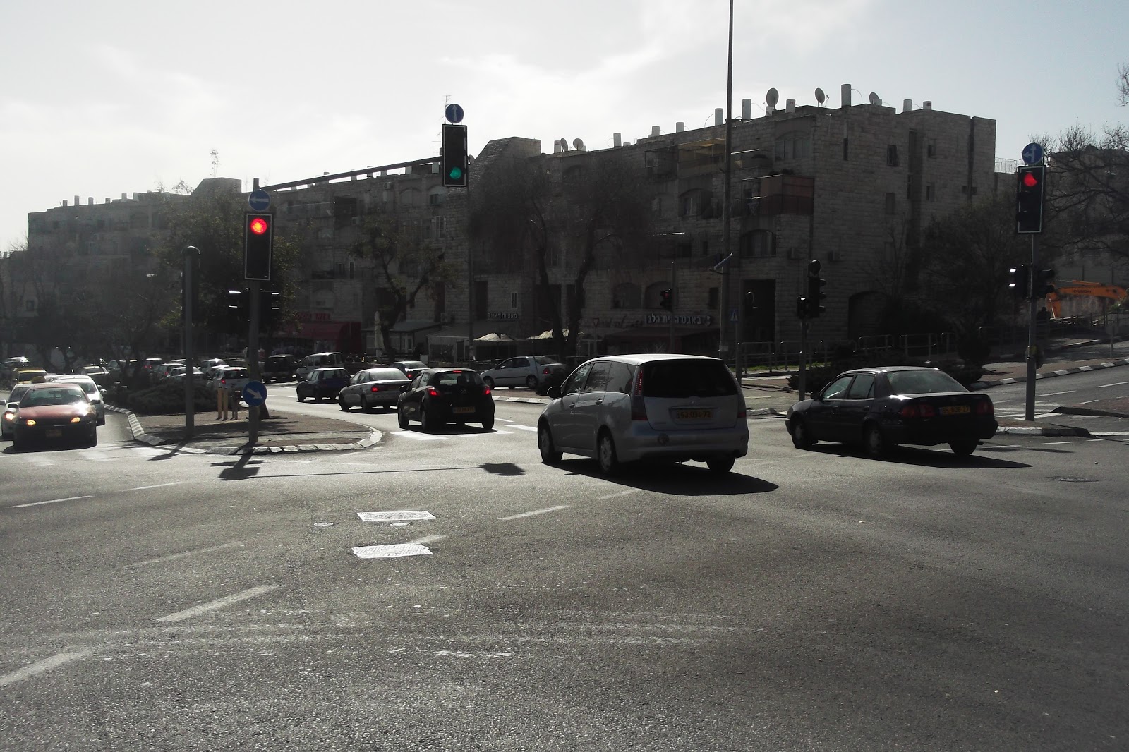
Gilo's unfriendly main street (HaGanenet segment)
Gilo is already bisected to some degree from north to south by Dov Yosef Road, and from east to west by another long road whose various segments are named HaRosmarin, HaGanenet and Tsviya-VeYitzhak. These roads are, in essence, highways, not neighborhood main streets or boulevards. Dov Yosef Road does not pretend to be anything other than a traffic artery connecting Gilo with the Malha Mall and the current Begin entry point at Golomb Street. By contrast, there is both residential construction and commercial activity along HaRosmarin, HaGanenet and Tsviya-VeYitzhak; however, these east-west roads (which, depending on the topography, either border a wadi or slice through built-up areas) are exceedingly wide, and range from four to six lanes with formidable dividers extending along much of them. Their main purpose is not to concentrate commercial or social activity within the neighborhood, but to channel automobile traffic to and from Dov Yosef Road and the Derech Hevron traffic artery to Gilo's east.

Gilo's main shopping complex is situated at the intersection of Tsviya-VeYitzhak and Leshem, and consists of a tiered outdoor center that is an accessibility nightmare and an adjacent indoor mall that cannot be reached safely by pedestrians.
Gilo central shopping complex
The complex's unfriendly design, unwalkable location, and proximity to the much larger Malha Mall, which most Gilo residents are able to reach within minutes by car, have been deadly to business; most of the Gilo Mall storefronts have lain empty for years. Zeidenberg Park, whose entry point lies diagonally across the road from the shopping center, represents a major investment in terms of play equipment and landscaping; but its location deep in a wadi and consequent invisibility at street level, as well as the multi-lane road that divides it from the shopping area, preclude any meaningful interaction between the sites. Gilo's community center, pool and library are nowhere nearby, having been situated in a strictly-residential enclave at the eastern end of the neighborhood; most residents, one may assume, access these amenities via private car, just as they would travel by car to amenities outside the neighborhood.Where a more human-scaled main street might have concentrated local commercial and social activity in a lively and effective way, an internal highway and car-oriented planning have separated the existing resources and made synergy between them impossible.

Gilo is not the only Jewish Jerusalem neighborhood to be divided by a highway; Ramot, at the city's northern end, is similarly bisected by Golda Meir Boulevard, and similarly characterized by a pedestrian-hostile distribution of local amenities. That is how these neighborhoods were planned. The assumption was that everyone would have cars, and use them not only to get to their jobs in other parts of town, but for most local errands as well.

Having established that the practice of running highways through Jerusalem neighborhoods is rooted less in discriminatory tendencies than in an auto-centric planning orientation, we are now free to look at the Begin extension, and its potential impact, from a broader perspective, one that encompasses not only Beit Safafa but the extension's supposed "beneficiary" neighborhoods, as well.

Will the Begin extension enhance the livability of Gilo, and of the other south Jerusalem neighborhoods and suburbs that it is meant to serve?

The Begin extension will terminate in Gilo, by the Tunnel Road interchange through which Gush Etzion motorists enter and exit the city. Gilo's community council is gushing about the extension's potential benefit to the neighborhood, in the form of "quick access" to "Jerusalem." I'm not sure, though, that Gilo residents currently feel cut off from "Jerusalem." As noted above, they already have quick access to the Malha Mall via Dov Yosef Road, the expeditious, if perilous, thoroughfare that actually brings them most of the way to their current Begin Expressway entry point at Golomb St. They are also quite close to the Talpiot Industrial Area, via Derech Hevron. When I recently stopped by the Gilo Mall in search of a new pencil case for my son and left empty-handed because the toy-and-school-supplies store (one of the few that I remembered as still being operational) had closed down, I was able to get to Talpiot by car in just a few minutes' time to continue my quest.


Poor pedestrian access and too close to Malha: empty storefronts in the Gilo Mall

  Gilo has a negative image. It is not thought of as a potential destination for the younger, educated people who have been organizing in Jerusalem in recent years under the Hitorerut BiYerushalayim and Ruah Hadasha rubrics, despite the fact that housing there is relatively affordable and access to the commercial and recreational hubs of Malha, Talpiot and Emek Refaim is convenient (a comparative advantage over such farther-flung northern Jerusalem neighborhoods as Ramot and Pisgat Zeev). The problem appears to lie with Gilo's inferior urban qualities -- its walkability deficit, lack of local shopping, inaccessible public amenities, etc.

These problems are ostensibly being addressed by Gilo's master plan project; yet the material that has coalesced up to now seems curiously shallow and unconvincing. One gains insight into the Gilo plan when one looks at the position papers that serve as background it, and which were drawn up with "resident involvement." These papers talk about remodeling and invigorating the main shopping area, densifying the neighborhood, improving walkability and public transit, improving linkage to the rest of the city, creating local jobs, and all sorts of things that are usually associated with good urbanism.

However, the most emotionally charged sections of the position papers are those that deal with roads and with parking. The sense of Gilo residents' preoccupation with where they are going to put their cars, with maintaining traffic flows and not being caught in traffic jams, is palpable, and is reflected on a practical level in the demand for added roads, road widenings, more extensive parking areas around the commercial centers and neighborhood amenities (including parks), and parking minimums of 2 spaces per unit in all new residential construction. The position papers note, matter-of-factly and neutrally, that Gilo is a "bedroom community," and that most residents get around by car, even within the neighborhood; these facts are presented as a status quo that is not up for negotiation. That the neighborhood's auto-oriented scale might be the root cause of its unattractiveness to the younger generation is an idea that appears not to have been entertained.

Under these circumstances one is tempted to ask, Shouldn't Gilo residents be given what they want? If they want more and wider roads and more places to store automobiles, shouldn't they get them? And if they want immediate entrance to the city's north-south automobile artery, why not provide it? They have been conditioned to depend on their cars, why try to change things?

But surely the counter-questions also need to be asked. Having already mentioned Gilo's stillborn shopping district and pedestrian-hostile main street, let's consider whether the extension is likely improve the status of either. Will encouraging Gilo residents (and the residents of nearby Har Homa and Gush Etzion) to use their private cars to travel, via Begin, to jobs, shopping and recreational facilities at the opposite end of town (in addition to relatively nearby Malha) have a beneficial effect on local businesses? A successful shopping area might conceivably be developed on HaRosmarin St., near the Trampiada/Tunnel Road entrance, to serve both the residents of that part of Gilo and those of Gush Etzion who pass through Gilo on their way to and from downtown Jerusalem (just as the Moshe Dayan Blvd. shopping complex successfully serves Mateh Binyamin and Neve Yaacov residents who pass through Pisgat Zeev). Will the direct link to Begin and consequent complete bypass of Gilo itself facilitate or hinder such commercial development in eastern Gilo? Will it do anything for Gilo's moribund existing shopping center? Will the perceived necessity of providing smooth access to Begin from within the neighborhood make a narrowing of Gilo's main east-west roads -- so desirable for walkability reasons -- at all a realistic prospect?

If efforts to improve public transit to and from Gilo are ever indeed undertaken (Mayor Nir Barkat's re-election platform claims that a "Blue Line" from Gilo to Ramot via the city center will be advanced during his next term), will they have any chance for success, given the Begin extension's implied encouragement of private car use?

All of these questions apply, in varying degrees, to Har Homa, the future Givat Hamatos neighborhood (wedged between Beit Safafa and Gilo), and the Gush Etzion suburbs. Will easier and closer access to Begin have a positive effect on commercial development in these areas? Will it encourage people to switch from private car to public transit? Will it foster good urbanism in these areas? Will it make them more desirable to a younger, less car-oriented generation?

In my next post, I hope to raise some additional questions regarding the Begin Expressway extension -- questions relating to the extension's impact on other parts of Jerusalem.

Tuesday, October 2, 2012

The downtown trophy wife

Is it sensible to take a center-city area that up to now has been characterized by a mix of uses, and to designate it solely for "culture and tourism?"

Relatedly: should historic buildings be, on principle, emptied of workaday uses and dedicated exclusively to "culture and tourism" uses (e.g., boutique hotels)?

Such is the approach that the Jerusalem Municipality is currently taking toward Jaffa Road and environs -- the area that most locals simply think of as "downtown" but which is increasingly being referred to as the "historic city."

I think that this approach needs to be subjected to public scrutiny. I, for one, see two major problems with it:

1) The segregation of uses that it imposes will make downtown Jerusalem a much less attractive destination for regular Jerusalemites and Israelis, essentially rendering it a tourist trap whose artificiality will be perceived by the more discerning tourists;

2) By removing historic buildings from circulation as facilities where normal, everyday activities take place, and by devoting them to tourist-oriented uses, the planning echelon will be dividing Jerusalemites and Israelis from their own architectural heritage, thereby impoverishing them culturally.

As noted in my last post, which discussed the recently-approved plan for a high-rise office park at Jerusalem's western entrance, Deputy Mayor Kobi Kahlon has stated that "anyone who doesn’t have to enter the city shouldn’t do so. Leave the historic city to culture and tourism.” Downtown Jerusalem, according to Kahlon, is simply too fragile to "take the load" of the governmental/clerical functions currently housed within it ("You toss out two pieces of paper there and the city is filthy"), and is altogether suited to the expression of "much greater meanings."  The idea is that certain activities are just too mundane for the traditional architecture of downtown Jerusalem, and should be transferred to the envisioned skyscraper complex at the city's entrance -- "Rova Mevo Ha'Ir."
 
Generali Building, via Wikipedia (Magister)
In keeping with this idea, government offices now located in Jerusalem's "historic city" are slated to be moved to Rova Mevo Ha'Ir. Furthermore, according to Haaretz, "the Planning and Building Committee is also discussing a plan to turn the old ministries' offices, some of which are located in historic buildings, into boutique hotels."

One building that has been mentioned as a prime candidate for such a re-purposing is the "Generali" Building at the corner of Jaffa Road and Shlomzion HaMalka St., built in the 1930s to house the offices of the Italian insurance agency Assicurazioni Generali. The Generali Building is currently home to a number of Israeli government offices, including the Interior Ministry's Jerusalem District administration.

I haven't had anything to do in the Generali Building in years and don't know to what extent Israeli citizens are inconvenienced by having to conduct their business in that particular location. Deputy Mayor Kahlon claims that the presence of government functions in buildings such as this one "cause[s] terrible traffic downtown, as well as parking shortages". I find this assertion rather curious, inasmuch as Jaffa Road has been closed for some time to vehicular traffic other than the light rail -- the idea being that people should get to that part of town via public transit and forego the use of their private automobiles. If you're riding the light rail, why do you need parking? How can there be traffic jams in a part of town where cars are no longer allowed?

I don't pretend to know whether public-sector efficiency is best served by concentrating government offices in one specially-designed compound -- i.e., Rova Mevo Ha'Ir. It does strike me, though, that when ordinary citizens come downtown to run errands at government facilities, downtown can only benefit-- since a citizen who enters the area for one purpose will likely remain there for others. Logically, it would seem that when downtown Jerusalem is emptied of its government offices, regular Jerusalemites and Israelis will have less occasion to go there. Are we quite certain that this is what we want?

I personally don't have much reason to go downtown, as most of my needs can be met in the Talpiot Industrial Area -- the badly-neglected "secondary" CBD that, in my view, actually functions as primary CBD for a sizeable chunk of Jerusalem's population.. However, this past summer I enjoyed a brief but instructive city-center idyll that brought home for me just what is wrong with the Kahlon plan for this part of town.

Mushtasfa Jerusalem (District Health Office building),
 via Wikipedia (Ranbar)
Pictured at left is a historic building at 86 Jaffa Road -- one that, presumably, the Municipality would want emptied of its governmental functions and turned into a boutique hotel. This Ottoman-era edifice was constructed in 1882 as a residence and later turned into a hospital; since the British Mandate period it has housed the Jerusalem district health office.

I had to bring my 3 year old daughter to this building several times this past summer, for a series of anti-rabies innoculations (after she was scratched by a stray cat). Never having needed the services of the district health office before, and having no prior knowledge of the facility's whereabouts, I was very pleasantly surprised to find myself ushering my daughter into this distinguished old structure, the formality of whose arched stone gate is set off by a soothing little front yard and welcoming, geranium-filled porch:


Rather than having to sit in an institutional waiting room for the prescribed 20 minutes post-innoculation, my daughter and I (and the other kids I brought along on the various vaccine visits) were able to enjoy our mid-morning snack out here on the district health office porch, joined by the occasional employee on coffee break. When we were through, we stayed downtown, running different errands each time. On one occasion we picked up inexpensive crafts supplies at a discount store; on another -- paperbacks at a second-hand bookshop. I got to familiarize myself with some clothing stores I had never seen before. We bought slushes and iced coffees, burekasim and cookies. We discovered a newly-renovated playground in the downtown area that constitutes a worthwhile destination in and of itself.

Had we not needed the services of the local rabies prevention unit, we would not have patronized any of the aforementioned downtown businesses. We simply wouldn't have been downtown.

Our forays to the city center were both enjoyable and productive. We didn't go there for the specific purpose of experiencing "culture." We got a healthy dose of "culture" just by taking care of some decidely mundane business at the scenic venue of the Jerusalem district health office. And we were able, afterward, to run a variety of errands on foot, within a radius of just a few city-center blocks. Culture and commerce, pleasure and efficiency -- the blessings of mixed-use development.

Unfortunately, current urban thinking in the Jerusalem Municipality appears to have stalled at the "separation of uses" stage. Much lip-service is being paid to the idea of mixed-use development, but the plans being actively adanced call for a fairly rigid compartmentalization of uses.

Whether 86 Jaffa Road in particular has a boutique future in store for it is not the point. The point is that Kobi Kahlon thinks "we have to empty [Jerusalem's historic downtown] of all the officialdom [פקידות] and other uses. This city has far greater meanings."

I'm sure that when Kahlon talks about Jerusalem's "greater meanings" his intentions are reverential -- and that is the problem. It's one thing to appreciate the city's history and to want to  preserve its unique character in those areas where "character" has a tangible presence in architectural form. However, putting specific parts of the city on a pedestal and dictating the kinds of uses that can take place in them, is quite another matter. It's almost like the objectification to which men sometimes subject women -- an idealization that ultimately devalues.  Rather than having someone alive and dynamic to relate you, you end up with a porcelain doll, a trophy wife, a puppet.

In the case of downtown Jerusalem, what we could end up with, if we're not careful, is a sterile museum in which tourists lap up lattes and empty their pockets to purveyors of kitschy Judaica while street mimes and jugglers leap and frolick in a frenzied effort to conceal the emptiness at the core of downtown -- a place where no actual work goes on, where no real life is lived, where nothing productive happens. 

We already have an "Old City" that is devoted to religion, tourism and religious tourism. Do we really want to start calling that part of town the "Old Old City?" Must Jaffa Road now become a "New Old City" -- a static Disneyland of handsome traditional architecture housing nothing but cafes and boutiques?

I don't want to be unfair to Kobi Kahlon. I have no problem with his desire to add office space in the city entrance area or even, necessarily, with the transfer of government agencies to that part of town -- provided that such transfers are clearly in the public interest. What bothers me is the assumption that governmental and commercial/corporate affairs are best managed out of dedicated skyscraper complexes, while historic downtowns and traditional architecture should play a merely ornamental role in the life of a city. In the present post I have looked at the latter half of this false dichotomy. In my next post I hope to discuss the former in greater depth.

Wednesday, August 29, 2012

Jerusalem's Rova Mevo Ha'Ir: copying the wrong Parisian model

A couple of decades ago, give or take half a decade, I spent an academic year in Paris on an American study abroad program. After 10 months of thumbing my little red Plan de Paris par arrondissement (= old-school GPS) to a pulp, I found myself facing a summer short on cash -- but unwilling to retreat to the States before I could legitimately claim to have spent an entire calendar year in Europe.

Luckily Georges, the heroically non-judgmental and patient program director, was able to arrange temporary work permits for such underfunded students who insisted on remaining abroad.

 Which was how I found myself, over a period of several weeks, shuttling from picturesque central Paris to the futuristic La Défense business district at the city's western outskirts, where I had landed a job heating up frozen croissants and serving "instant" espresso to those employed in the surrounding skyscrapers.

La Défense -- Stairway to Heaven by
Dmitri A. Mottle, via Wikimedia Commons
By "shuttling" I of course mean a Métro ride, but a space-shuttle association would not be far off the mark. Going to La Défense was like rocketing or beaming up to the moon or some kind of space station carved into a forbidding alien landscape that, by dint of hard labor, had been made marginally habitable for humans, but not attractive to them. Considering that I had spent most of a year tirelessly criss-crossing the streets of traditional Paris, it says something that I never spent a moment in La Défense beyond what the timeclock dictated. The fact that I was working -- though technically in Paris! -- in a fast-food joint  à l'américaine, serving up bad imitation French cuisine to Frenchmen and Frenchwomen who, in any other setting, would surely have turned up their noses at such travesties, said it all.

So my question is, why would Jerusalem want to do this to itself?

The Israeli (and international) media have lately been abuzz (in English: here, here and here) over an "ambitious" plan to transform Jerusalem's western entrance area -- referred to in Hebrew as Rova Mevo Ha'Ir -- into a sleek and ultramodern business district, complete with the skyscrapers that are thought necessary to project a municipal image of exuberant money-making. "The city as economic engine."

The plans for Rova Mevo Ha'Ir have actually been in the works for several years (Mayor Nir Barkat, who assumed office in 2009, was the project's primary initiator). When the plans were first publicized, a similarity to Paris' La Défense district was proudly proclaimed. Apparently,  the mere hint of a resemblance to something European was thought sufficient to place the project in a positive light.

La Défense is not normally considered a success from the perspective of urban vitality. One author and lecturer in the urban planning sphere, Alex Marshall, calls the complex "stunningly dead." Charles Siegel , writing recently at Planetizen, points out that there are better models for smart growth than the "stale modernist model of La Défense." In fact, when the Rova Mevo Ha'Ir plans were first publicized in 2009, and hailed as Jerusalem's answer to La Défense, Siegel commented, again at Planetizen, "Virtually everyone agrees that La Défense blighted Paris' skyline and is an anti-urban design. Just what Jerusalem needs to destroy its historical character."

Unfortunately, those charged with planning Rova Mevo Ha'Ir seem unable to differentiate between design elements likely to foster vibrancy and ones liable to create deadness. Much lipservice is paid to designing with the pedestrian in mind, but the plans themselves paint a different picture.

The slideshow prepared by Farhi Zafrir, the architectural firm that won the Rova Mevo Ha'Ir competition, is a frustrating mish-mash of declared aspirations to walkable urbanism and simulation images that give such aspirations the lie.

Not the least annoying feature of the slideshow is its dubious referencing of traditional city design -- its deployment of photos of bustling European streets featuring human-scaled low- and mid-rise architecture -- in order to "prove" the value of the monolithic skyscraper project that it is actually trying to sell.

Farhi Zafrir first make a ploy for audience sympathy by describing, in Slide 2, the current sorry state of the Jerusalem entrance area. That part of town is certainly a mess -- as the architects put it, "sparse and dispersed construction," "separate and isolated compounds," "a roadway rather than a street." The pictures speak for themselves. Yes, almost anything would be better.

In Slide 3 the architects treat the viewer to a warm and fuzzy photo selection featuring narrow, Nathan Lewis-type streets, European version, full of fine-grained architectural detail and hip young city dwellers doing their thing en masse. "Priority to pedestrians" is the slogan here.

Having been thus buttered up, the viewer is then meant to be duly impressed by slides 4-11, which show us how Farhi Zafrir are going to rescue us from the dreaded stroad situation that currently exists, by building an architecturally monotonous, dedicated business, government-office and hotel district (the Israeli planning echelon's idea of "mixed-use development").


via Jerusalem Municipality

Yes, there is an emphasis on transit-oriented development here -- the project's much-touted connectivity to the Jerusalem light rail and the (future) high-speed Tel Aviv -Jerusalem train. Yet it is disturbing that all this accessibility is meant, ultimately, to keep people out of Jerusalem's historic downtown -- to artificially, and in a sense even dictatorially, concentrate certain activities -- and the people engaged in them -- in this one particular area.

For instance, the idea of transferring government ministry offices from their current locations in historic downtown buildings to the sterile office park of Rova Mevo Ha'Ir, and of turning the historic buildings into boutique hotels, may seem, at first glance, to have a certain poetic justice -- relegate the dry government paper-shufflers to dull modernist edifices! Save the pretty buildings for hunky and babalicious vacationers who can appreciate them! -- but it flies in the face of everything the New Urbanists have been telling us about real mixed-use development and the vibrancy it produces.

Deputy Mayor Kobi Kahlon has been quoted as saying, "Anyone who doesn't have to enter the city shouldn't do so. Leave the historic city to culture and tourism."  That is one of the most disturbing statements I've heard/read in a long time. Kahlon feels that by diverting jobs and government offices to the Jerusalem entrance, the "historic city" will be spared traffic congestion and "parking shortages." Unfortunately, it may also become depleted of anything resembling real life, and turn into a giant museum. I'm reminded of Alan Davies' (The Urbanist) recent description of Venice
In a physical sense Venice is pedestrian nirvana, but in my opinion it’s also a one dimensional city. The throngs of people along the canals are almost all tourists. The businesses only provide lodgings, food and fodder for tourists.
Is that what we want Jerusalem's historic downtown to become?

 My special bugbear: the Farhi Zafrir slideshow references La Défense (slide 12), in a manner that can only reflect ignorance or disingenuousness on the part of the designers.

I can't seem to copy the slides into the blog, but here is a La Défense plaza photo very similar to that used by Farhi Zafrir in slide 12 of their presentation:


David Monniaux via Wikipedia
The above photo (that is, its counterpart in slide 12 of the architects' presentation) is grouped together with a couple of photos of traditional European public squares, including an open-air market scene that looks something like this:

Street market at the bottom of  rue Mouffetard -- David Monniaux, via Wikimedia Commons

Farhi Zafrir's aim is to entice the viewer with street scenes that most people would be happy to see in their own city, and which the viewer is meant to understand that the architects are going deliver via their proposed Jerusalem entrance project. Yet one can see at a glance that the La Défense scene (the one that most closely resembles Farhi Zafrir's Rova Mevo Ha'Ir simulation) has little in common with a traditional street market scene.

In the La Défense photo, people scuttle like insects across an exceptionally uninviting, oversized plaza, dwarfed by brutal-looking buildings that do not work together as any sort of defined streetscape or provide the sense of enclosure that human beings generally require if they are to feel comfortable in a given built environment.

In the traditional-Paris street market photo, you've got it all: lovely and varied architecture on a human scale, enclosure, "intimate anonymity."

I humbly submit that this grouping of a photo of the La Défense plaza together with photos of traditional European public squares is a cheap ploy intended to persuade the public that a relatively isolated, limited-use high-rise complex can offer the pleasing urban ambience of a more traditionally-designed quarter. In my view, this reflects questionable ethics on the part of Farhi Zafrir.

It is too bad that the local planning echelon, and the architectural firm that it chose to design Rova Mevo Ha'Ir, couldn't have mustered up a bit more ambition, and devised a plan that would have increased Jerusalem's office-space supply in a style that respected the city's architectural traditions -- as in the Le Plessis-Robinson model described so compellingly by Charles Siegel. As Siegel points out, neo-traditional development can be "dense enough for smart growth" and can deliver its density "in a more attractive and livable environment than the typical modernist development."

But very likely there are no templates for neo-traditional design in the software used by Farhi Zafrir -- so they settled for a stark modernist office park, hoping to pass it off as successful urbanism.

Monday, July 16, 2012

Brander Park and Gardens, City Center -- a Jerusalem Playground Review


I recently had the pleasure of visiting a renovated playground in the city center -- the "revitalized downtown Jerusalem" that I sometimes mock in a spirit of contrarianism. This wonderful new playground definitely creates an incentive (which I previously found lacking) to go downtown with the kids ...
Name: Brander Park and Gardens
There is a plaque identifying the park's donors as  Dr. Jerome and Mrs. Frances Brander of Atlantic City. On maps, however, the area seems to be called Meir Sherman Garden. When the conundrum has been resolved, Gd willing, I will update.

Location: King George Street, downtown Jerusalem (adjacent to Independence Park).

Transit: Egged lines 4, 4A, 7, 7A, 8, 8A, 9, 9A, 17, 17A, 19, 19A, 21, 21A, 31, 031, 32, 032, 38, 74, 75.
Shade: There's plenty of shade in this park, making it quite usable at all hours of the day, even when the sun is at its harshest. In addition to the many trees scattered throughout, some of them quite old and venerable ...


... there is the welcome addition of a large artificial shade structure covering a selection of attractive, new-style "dynamic" play equipment.


Obviously these shade structures cost money and one can't expect that every corner of a playground will be encompassed by them. Still, it's kind of a shame that this line of cool and varied swings is so entirely exposed to the sun -- I doubt one can use them comfortably after about 9:00 a.m.:


All in all, though, this is a well-shaded playground/park, where at least half of the play equipment is sufficiently shaded for mid-day use, and where comfortable picnic spots can always be found:


Play equipment and features:

Play equipment seems to have its own fashion trends, which wax and wane. A few years ago every new playground in these parts featured a climbing/slide structure with tunnels and turrets, a kind of all-in-one facility around which the entire play area revolved -- like the department store on which a mall is "anchored."

Over the last couple of years, however, things seem to have evolved. My first inkling of the changing times came on a family trip to Zichron Yaacov two summers ago, where we were enchanted by what seemed to us a wonderfully original playground full of strange kinetic-dynamic-futuristic play structures of a kind we had never seen before.

Now these structures are popping up here in Jerusalem as well. The novelty hasn't worn off yet -- maybe it never will:


As noted above, an entire section of the playground is devoted to the swing concept in a variety of ultramodern incarnations. The swings are attractive and fun -- for older children; none is suited to a toddler, unless she's in someone's lap ...


There's a separate toddler play area with some nice features, including this sleek bouncy snake:


The train structure is very attractive, but was in full sun and hot to the touch at around 10:30-11:00 a.m. when we were there:


Other notable features and amenities:

-- Bicycle racks

-- There's a regular water fountain near the toddler play area, and a more "advanced" one off the older-child area -- the water is chilled, and the fountain has a bottle-filling installation:


-- Rarity of all rarities in Jerusalem playgrounds: a restroom. My son tried to get in but couldn't figure out how. I have no idea whether it works, is cleaned/maintained, etc. Nor do I want to be the one who checks this out. Perhaps an intrepid reader will care to update me on this, for the benefit of the wider public ...


-- Brander Park leads directly into the larger, open green space of Jerusalem's well-known Independence Park, an area suitable for picnics, ball-related activities, gatherings, etc. Independence Park has no play facilities per se and I never thought of it as a full-service attraction in and of itself for kids, but nowadays it makes a nice, relaxing side-trip when everyone has tired themselves out on Brander Park's exciting play equipment. Of particular interest is the man-made water feature -- small pools and streams, mainly in shade, that attract kids like flies and offer adults a cool and refreshing interlude amid the downtown bustle:


But don't bring your bathing suit, or drink the water. It might embalm you:


Age range: Toddler through adult:


Snack factor: Many restaurants, cafes, bakeries and convenience stores a short walk away on Jaffa Rd. and along the Ben Yehuda pedestrian mall; a kiosk selling ice creams/ices, snacks and cold drinks (as well as less child-oriented items such as lottery tickets and cigarettes) is located at the park's Meir Shaham St. entrance.

Schmooze factor: This is not the kind of playground you go to in order to meet up with a regular crowd of neighborhood moms and childminders -- a valuable feature of certain other playgrounds that I have reviewed.. Brander Park is downtown, so it gets a more transient and varied clientele, and that is its strong point and brand differentiation. One sees locals of all stripes, tourists, plenty of dog-walkers, etc.

Seating: Seating has been handled thoughtfully and generously throughout the park, whether in the form of wooden benches (a fair number in shady spots), a circular stone bench surrounding the main play area, or stone tree and shrubbery platforms that do double duty as seating:


Multiple uses within the park: Brander Park certainly has much to offer within its borders, especially if those borders are extended to include Independence Park. It has several play areas (suited to different age groups) that are distinct and intimate yet flow gracefully into each other; lawns for kicking a ball around, picnicking, etc.; steps and platforms that beckon young children to climb on them; the babbling brook of Independence Park; areas of noisy togetherness and spots of repose. You won't be bored here.

Beyond the park: Self-evident, considering the downtown location. In the immediate vicinity, on King George Street, are certain tourist-itenerary items such as Yeshurun Central Synagogue, the Great Synagogue and Heichal Shlomo.

Prior to the renovation, I never considered this playground to be anything that I would travel out of my south Jerusalem comfort zone for. In general, I always regarded downtown as rather child-unfriendly and resented the lack of a worthwhile play area there. I never could bring myself to run errands in the city center with kids in tow. I've hardly been downtown at all these last few years, as most of my needs can be met closer to home (i.e., in Talpiot); in fact my unexpected recent forays there were occasioned by nothing less than the necessity of getting my three year old vaccinated against rabies at the Health Ministry facility at 86 Jaffa Rd. I dreaded the trip downtown with her, thinking that Brander Park, as I remembered it (a rickety old merry-go-round?), would not compensate her adequately for the innoculation experience. In the end I was pleasantly surprised on all counts: the rabies prevention unit is run efficiently and located in a beautiful old building that is worth visiting on its own merits; the little one was enthralled by the shop windows of Jaffa Rd. and the passing trains; and I discovered the Brander Park renovation.

I'm not naive. I know the Jerusalem Municipality didn't have lowly residents like me in mind when it decided to renovate this playground, but rather the tourist population. Yet this is one instance where the locals truly enjoy a collateral benefit. "Mixed-use" has become a catchword of the downtown Jerusalem revitalization scene, but it appears to refer mainly to a mix of commercial, office and hotel/residential space in new high-rises slated for construction. Yet by creating a truly fun place for children in the city center, the planning echelon has done much to enhance downtown Jerusalem's mixed-use status -- without having to reach skyward.

Friday, May 25, 2012

A Memorial to Bad Urbanism on Derech Beit Lechem

Derech Beit Lechem, or Bethlehem Road, is a long street that runs through Jerusalem's Baka and Talpiot neighborhoods, parallel to the thunderous traffic artery of Derech Hevron. Derech Beit Lechem, though itself a busy thoroughfare in parts, would not normally be called "thunderous" (a car word) but rather "bustling" (a people word). When one talks about Derech Beit Lechem one tends to draw on a lexicon of chicness and boutiques, cafes and gentrification.

This vocabulary mainly describes the section of Derech Beit Lechem that extends between Rivka Street (near "Tsomet HaBankim") and Yiftah Street. There is considerable urbanist consciousness in that part of town; Baka activists have garnered media attention by protesting planned changes in traffic patterns that would, in the words of architect and Baka resident David Guggenheim, "have destroyed the delicate urban fabric" of Derech Beit Lechem.

There is, however, another Derech Beit Lechem -- one whose urban fabric is not so delicate: the Talpiot Industrial Area end of the street, between HaTenufa and Derech Baram. On this stretch of Derech Beit Lechem, one side of the street features old industrial buildings ...


... flanking a forlorn, vacant lot where the infamous Versailles wedding hall disaster occurred eleven years ago yesterday, on May 24, 2001. No one, apparently, wants to build something new here:

Site where the Versailles wedding hall once stood, now offering a direct view of the ubiquitous Holyland project.

The opposite side of the street, on this stretch of Derech Beit Lechem, houses some of Jerusalem's poorer residents, in a compound of decrepit shikun buildings (1950s-era mass housing for immigrants) currently slated for urban renewal:


And it is on this side of the street, directly across from the now-desolate space where the Versailles disaster occurred, that a "memorial garden" has been created in honor of the disaster's victims:


Is it just me, or does this "garden" seem wholly inappropriate, whether as a memorial to the casualties of a collapsed dance floor, or as a feature of a street where, after all, human beings continue to live and go about their business? Well, I guess if I thought it was just me, I wouldn't be writing this post, would I?

Here's what I think is wrong with the Versailles memorial site:

1) It has a distinctly military-cemetery feel, as though the designer (architect David Guggenheim -- the Baka activist mentioned above) thought the site was meant to commemorate a battle where heroic warriors fell, rather than a civil disaster. Those tall, straight-arrow cypress trees standing at attention under the brutal midday Mediterranean sun, surrounded by a stark grey concrete wall bearing the names of the fallen ... This military ambience is all wrong, given the civil nature of the incident.


2) The site is unsuited to an area where, as I noted above, people live, play, work, and pursue everyday activities. Basically, a large chunk of public space was hijacked and turned into something that no one can use. This isn't a cemetery, it's a street. Would David Guggenheim want something like this on his end of Derech Beit Lechem?

To be more specific about why the memorial is unsuited to an area where people live and "do stuff" (as opposed to a military cemetery or some kind of national battlefield park):

-- The "garden" is shadeless, meaning that no one can spend time there during normal daytime hours. Wouldn't it have been more meaningful, a more fitting remembrance of the departed, to have planted some shade trees, and arranged them in an inviting way, with some benches under them, creating what we refer to in Hebrew as a pinat hemed -- a "cosy corner" that would have elicited gratitude from local residents and passersby, and, perhaps, have stimulated actual contemplation of the names of the disaster victims -- rather than concealing them?


-- The overall layout is such that one can't be in the site; one is forced to
walk around it. As I said: a hijacking of public space. One can speculate that Guggenheim intended something deep by this: perhaps the set-up of trees-mounted-on-a-platform, upon which we gaze as outside observers, was meant to evoke the moment just before the dance floor collapsed beneath the wedding revellers -- a moment that was captured for posterity on video, and viewed by many thousands of people.

Whatever visual metaphor Guggenheim had in mind, it does not, in my view, justify the removal of a public space from public use. The local residents didn't cause the disaster. Why should they not have the use of their street in its entirety, and in aesthetically pleasing form?

And if the site of the catastrophe itself -- directly across the street from where the memorial "garden" was installed -- has lain desolate for the past decade, wouldn't that have been the logical venue for a monument of some kind?

-- Also, what's with the grey, blank wall on the outside of the memorial? 


Not that it was necessary or desirable to have this grey starkness on the interior walls, either -- but how can one justify putting a blank wall directly across from what is, essentially, a nice, modest, pleasantly dense and human-scaled stretch of multifamily dwellings:


The Versailles disaster, in which 23 people perished and 350 or more were injured due to "quick and dirty" construction methods and owner negligence, demonstrated one kind of price that society pays when the needs of actual human beings are treated with cavalier disregard by those responsible for our built environment.

The Versailles disaster "memorial garden" demonstrates another cost that we incur, as a society, when those responsible for our built environment disregard the needs of actual human beings. No, no deaths are likely to be directly caused by an ugly and unusable memorial garden. But I would argue that negative urban features such as these have a cumulative effect. They make it seem okay to do inappropriate things with the street; to design and build inappropriately. They alienate us from the street, with devastating effects on our quality of life and long-term health. Twenty-three fatalities in one shot is indeed a terrible tragedy. But when, as a society, we adhere to a lifestyle in which the street is a place to be avoided, we suffer health consequences that, though more insidious, reach much farther.